Investigation of a |
MAHS volunteers located the crash site in May of 1996 using a fishfinder and published LORAN numbers.
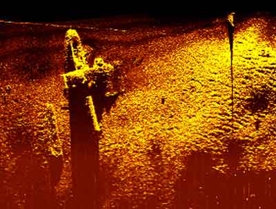
A year later, a side-scan sonar image taken by Marine Sonic Technologies, Ltd., of White Marsh, Virginia,
showed the wreckage in some detail. |
|
|
Next | |