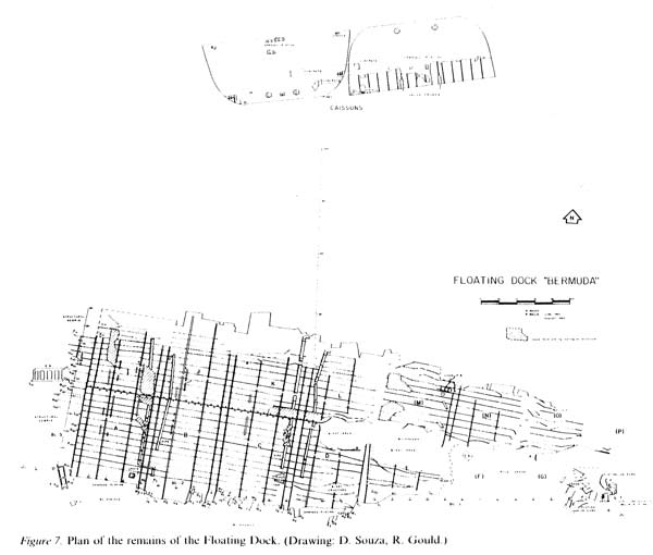
The main wreckage appears in the lower part of the map. The frames, or stringers, are intact in the left half of the structure. Gaps to the right appear to
represent the results of the blasting undertaken in the 1950s.
The two features above are large caissons, the removable ends of the drydock that were used to seal the structure. They are lying on their sides.
|