MAHS

BERMUDA
Archaeological Investigation of the Schooner CONSTELLATION


Constellation


The wreck lies in 30 feet of water and is a popular dive site for beginner and novice divers visiting the island.   The aim of the MAHS project was to map the site providing the Maritime Museum with a tool to help enhance the experience of visiting divers.


MAHS completed a site plan that could be reproduced on a slate or heavy mylar to be made available to divers.   The plan provides orientation on the wreck site as well as supplying additional information about the site such as its history and explanations of some of the surviving features.


Documenting Hull #1

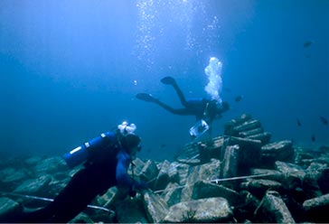
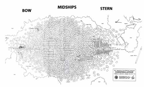
The site was divided into three sections for mapping purposes:   bow, midships, and stern.   Mapping of each section was conducted using MAHS' basic field documentation technique, baseline trilateration.


Next   |

Previous   |

MAHS Project List